

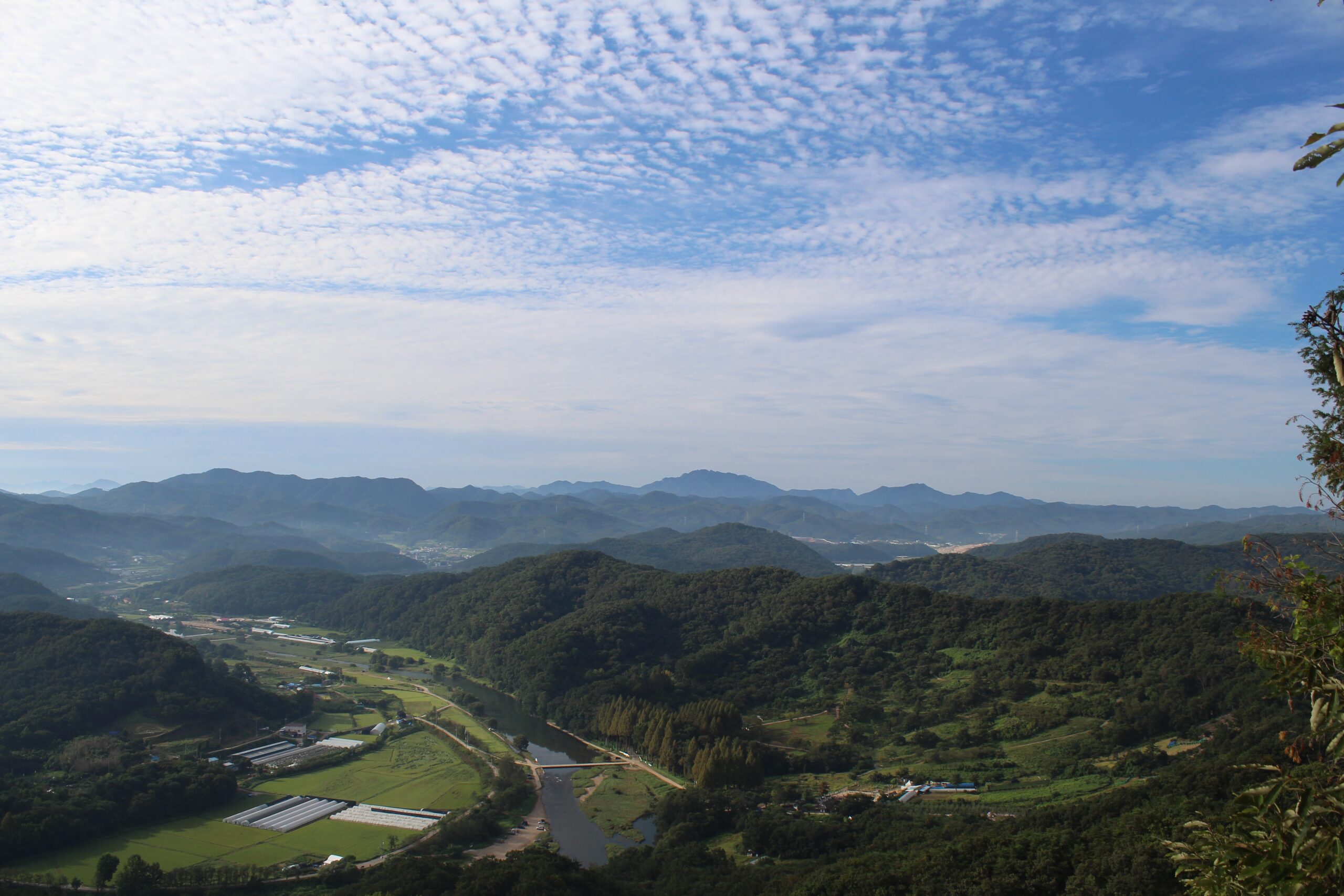
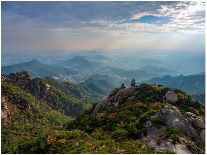
The mountains of South Korea are unquestionably among the most remarkable features of the diverse and beautiful topography of this northeast Asian nation. South Korea’s main mountains are among the most impressive in all of Asia. The terrain in Korea is extremely mountainous and rugged. South Korea contains three mountain ranges. These mountain ranges are the Sobaek Mountain Range, the Taebaek Mountains, and the Jiri Mountain Range. People who visit South Korea are frequently surprised by the mountainous terrain. The majesty of the landscape inspires awe, and for those on vacation in South Korea, it provides an abundance of recreational opportunities. Due to the attractiveness and accessibility of numerous mountains in South Korea, trekking is always one of the most popular activities.
Baekdu-daegan Mountain Range

Baekdu-daegan is a traditional Korean conception of the Korean peninsula’s mountains and watersheds. It spans the majority of the Korean peninsula, approximately 1500 kilometers, from Baekdu Mountain in the north to Jirisan or Hallasan in the south. Baekdu-daegan includes the Sobaek mountain range and the majority of the Taebaek mountain range, according to Western-style geography. Baekdu-daegan is an integral part of traditional Korean geography and Pungsu-jiri (the Korean equivalent of feng shui). Despite the fact that it is presently impossible due to the Korean Demilitarized Zone separating North and South Korea, hiking the length of the mountains is viewed as a desirable objective in line with the Korean unification movement. The 687 km section of the range in South Korea is popular for mountaineering.
Baekdu-daegan is a 1500-kilometer-long mountain range that stretches from Paektu Mountain in the north to Cheonwangbong Peak in the south.It could even include Hallasan on the island of Jeju. In addition, the concept defines the watershed of the peninsula and identifies 13 jeongmaek, branching mountain ranges that effectively channel Korea’s most important rivers to the ocean. A ridge that no body of water has ever crossed.
In South Korea, traversing the 687 km South Korean section of the trail, generally from south to north until the Korean Demilitarized Zone, is regarded as a noteworthy accomplishment. The South Korean government designated the trail as a national park for nature preservation in 2006. Also pertinent to Korean reunification sentiment is the desire to hike through the border to Paektu Mountain.
T’aebaek Mountains
T’aebaek Mountains, Korean T’aebaek-sanmaek, principal ridge of the Korean Peninsula, extending along the coast of the Sea of Japan (East Sea) north to Hwangnyong Mountain (4,160 feet [1,268 m]), North Korea, and south as the Kyngsang Range to Tadae-p’o, a suburb of Pusan, South Korea. The length of the T’aebaek range is 300 miles (500 km) and its average height is 2,600–3,300 feet (1,000 m). Peaks include Kŭmgang (5,374 feet [1,638 m]), Sŏrak (5,604 feet [1,708 m]), Odae (5,128 feet [1,563 m]), and T’aebaek (5,121 feet [1,561 m]). The eastern side of the mountain range forms a steep fault line leading to the coast, whereas the western side forms a moderate slope. There are numerous spurs to the southwest, including the Sobaek, Charyng, and Kwangju mountains. T’aebaek Mountains are the source of South Korea’s most significant rivers, including the Han, Naktong, and Km. There are extensive forests and iron, coal, tungsten, fluorite, and limestone mineral resources.
Prominent peaks of the range include Mount Seoraksan (1,708 m), Mount Kumgangsan (1,638 m), Mount Taebaeksan (1,566.7 m) and Mount Odaesan (1,563 m). In the east, the mountain range drops precipitously into the ocean, whereas in the west, the slopes are more gradual. Numerous extensions extend southwest. The Han River and the Nakdong River, the two most prominent rivers in South Korea, both originate in the Taebaek Mountains.
Sobaek Mountains
The Sobaek Mountains are a mountain range that traverses the southern peninsula of Korea. They diverge from the Taebaek Mountains and traverse the peninsula’s center in a southwesterly direction. Tradition holds that they reach their southeastern limit at Jirisan, which is also the range’s highest peak. Other notable mountains in the range are Songni Mountain, Joryeong Mountain, Gaya Mountain, Worak Mountain, and Sobaek Mountain. In general, the peaks of the Sobaek Mountains are well above 1000 meters above sea level.
The Sobaek Mountains constitute the southern portion of the Baekdu-daegan, the “spine” of Korea. They represent the traditional boundary between the regions of Honam and Yeongnam. In the Sobaek Mountains, there are numerous locations to explore. Whether you enjoy hiking or cycling, Sobaek Mountains is a region with seven concealed treasures just waiting to be discovered.
Dongdae Mountain Range
The Dongdae Mountains are a minor range that extends from the Taebaek Mountains. They traverse the South Korean communities of Pohang, Gyeongju, and Ulsan along the east coast. Toham Mountain in Gyeongju National Park and Dongdae Mountain itself in Ulsan are notable peaks. The Dongdae Mountains separate the basin of the Hyeongsan River from the band of small streams that discharge directly into the Sea of Japan (East Sea).
This mountain range extends along the east coast of South Korea for several kilometers, encompassing Pohang, Gyeongju, and Ulsan.This mountain range’s tallest peak is Tfkhanov, which is more than a thousand meters tall. There are numerous Buddhist temples and monasteries in the highlands.On the mountain slopes, there is a coniferous forest of pines and cedars, as well as a rare azalea.
Yeongnam Alps


The Yeongnam Alps are a collection of relatively lofty mountains located in the Yeongnam region of southeast South Korea. They are considerably shorter than the European Alps, measuring just over 1000 meters. The term is sometimes limited to summits exceeding 1000 meters in height, but may be extended informally to include lower peaks within the same region.
At the junction of Gyeongsangnam-do, Gyeongsangbuk-do, and Ulsan, the Yeongnam Alps occupy a limited region. Gyeongnam is in Sannae-myeon, Miryang; Gyeongbuk is in Unmun-myeon, Cheongdo; and Ulsan is in Sanguk-myeon, Ulju-gun.
The area is a popular destination for domestic tourism in South Korea. This is due to both the mountainous landscape and the abundance of landmarks in the region. These include sanctuaries like Tongdosa and Pyochungda, the “ice valley” Eoreumgol, numerous waterfalls, and a hot spring.
The mesmerizing silver grass fields that cover the mountain ridges of the 255-square-kilometer-large Yeongnam Alps attract a large number of travelers each autumn. The trails Haneul Eoksae-gil (Sky Silver Grass Trail) and Dulle-gil traverse the Yeongnam Alps.
Jiri Mountain Range
Jirisan is a mountain located in South Korea’s southern region. It is the second-highest mountain in South Korea, after Hallasan on Jeju Island, and the tallest mountain on South Korea’s mainland. Jirisan is located at the southern extremity of the Sobaek and Baekdu-daegan mountain ranges, the “spine” of the Korean Peninsula consisting of the Sobaek and Taebaek mountain ranges.
Jirisan is home to approximately 1,500 plant species, many of which are endemic. This is the greatest plant growth in South Korea, excluding Mount Halla. Some flora with the names ‘Jirisan’ or ‘Jirisan’ were first discovered on Mount Jiri. However, some plants do not have ‘geori’ or ‘geori’ affixed to them, despite their discovery on Mount Jiri.
Each year, more than 280 thousand individuals visit Jirisan. Summer and fall are the most popular seasons for tourism. The mountain is promoted as having ten breathtaking vistas.
In conclusion
The Korean peninsula is covered in mountains. Mountains create natural barriers and distinct regions throughout Korea. South Korea’s awe-inspiring geography is one of the country’s greatest attractions. South Korea is a land of many natural marvels, from its towering mountain ranges to its verdant valleys and foothills, which are home to numerous revered temples.